Digital Humanities
This theme explores the application of Visual Analytics, Information Visualization, Immersive Analytics, HCI, VR and MR in the context of Humanities, an in particular Digital Heritage.
Collaborators (in various publications)
Bangor University, Lancaster University, University of Essex
Related Publications
J. Pereda, P. Murietta-Flores, P. D. Ritsos, and J. C. Roberts, “Tangible User Interfaces as a Pathway for Information Visualisation for Low Digital Literacy in the Digital Humanities,” in 2nd Workshop on Visualization for the Digital Humanities, IEEE Conference on Visualization (VIS), Phoenix, Arizona, USA, 2017.
Information visualisation has become a key element for empowering users to answer and produce new questions, make sense and create narratives about specific sets of information. Current technologies, such as Linked Data, have changed how researchers and professionals in the Humanities and the Heritage sector engage with information. Digital literacy is of concern in many sectors, but is especially of concern for Digital Humanities. This is due to the fact that the Humanities and Heritage sector face an important division based on digital literacy that produce gaps in the way research can be carried out. One way to overcome the challenge of digital literacy and improve access to information can be Tangible User Interfaces (TUIs), which allow a more meaningful and natural pathway for a wide range of users. TUIs make use of physical objects to interact with the computer. In particular, they can facilitate the interaction process between the user and a data visualisation system. This position paper discusses the opportunity to engage with Digital Humanities information via TUIs and data visualisation tools, offering new ways to analyse, investigate and interpret the past.
[Abstract]
[Details]
[PDF]
H. C. Miles, A. T. Wilson, F. Labrosse, B. Tiddeman, S. Griffiths, B. Edwards, P. D. Ritsos, J. W. Mearman, K. Möller, R. Karl, and J. C. Roberts, “Alternative Representations of 3D-Reconstructed Heritage Data,” ACM Journal on Computing and Cultural Heritage (JOCCH), vol. 9, no. 1, pp. 4:1–4:18, Nov. 2015.
By collecting images of heritage assets from members of the public and processing them to create 3D-reconstructed models, the HeritageTogether project has accomplished the digital recording of nearly 80 sites across Wales, UK. A large amount of data has been collected and produced in the form of photographs, 3D models, maps, condition reports, and more. Here we discuss some of the different methods used to realize the potential of this data in different formats and for different purposes. The data are explored in both virtual and tangible settings, and—with the use of a touch table—a combination of both. We examine some alternative representations of this community-produced heritage data for educational, research, and public engagement applications.
[Abstract]
[Details]
[PDF]
[doi:10.1145/2795233]
J. C. Roberts, J. W. Mearman, P. D. Ritsos, H. C. Miles, A. T. Wilson, D. Perkins, J. R. Jackson, B. Tiddeman, F. Labrosse, B. Edwards, and R. Karl, “Immersive Analytics and Deep Maps – the Next Big Thing for Cultural Heritage & Archaeology,” in Visualization for Digital Humanities Workshop, IEEE Conference on Visualization (VIS), Baltimore, MD, USA, 2016.
Archaeologists and cultural heritage experts explore complex multifaceted data that is often highly interconnected. We argue for new ways to interact with this data. Such data analysis provides a ‘grand challenge’ for computer science and heritage researchers, it is big Data, multi-dimensional, multi-typed, contains uncertain information, and the questions posed by researchers are often ill-defined (where it is difficult to guarantee an answer). We present two visions (Immersive Analytics, and Deep Mapping) as solutions to allow both expert users and the general public to interact and explore heritage data. We use pre-historic data as a case study, and discuss key technologies that need to develop further, to help accomplish these two visions.
[Abstract]
[Details]
[PDF]
P. D. Ritsos, A. T. Wilson, H. C. Miles, L. F. Williams, B. Tiddeman, F. Labrosse, S. Griffiths, B. Edwards, K. Möller, R. Karl, and J. C. Roberts, “Community-driven Generation of 3D and Augmented Web Content for Archaeology,” in Eurographics Workshop on Graphics and Cultural Heritage (EGGCH) - Short Papers and Posters, Darmstadt, Germany, 2014, pp. 25–28.
Heritage sites (such as prehistoric burial cairns and standing stones) are prolific in Europe; although there is a wish to scan each of these sites, it would be time-consuming to achieve. Citizen science approaches enable us to involve the public to perform a metric survey by capturing images. In this paper, discussing work-in progress, we present our automatic process that takes the user’s uploaded photographs, converts them into 3D models and displays them in two presentation platforms – in a web gallery application, using X3D/X3DOM, and in mobile augmented reality, using awe.js
[Abstract]
[Details]
[PDF]
[doi:10.2312/gch.20141321]
P. D. Ritsos, D. J. Johnston, C. Clark, and A. F. Clark, “Engineering an augmented reality tour guide,” in Eurowearable, 2003. IEE, Birmingham, UK, 2003, pp. 119–124.
This paper describes a mobile augmented reality system intended for in situ reconstructions of archaeological sites, The evolution of the system from proof of concept to something approaching a satisfactory ergonomic design is described, as are the various approaches to achieving real-time rendering performance from the accompanying software. Finally, some comments are made concerning the accuracy of such systems.
[Abstract]
[Details]
[PDF]
[doi:10.1049/ic:20030157]
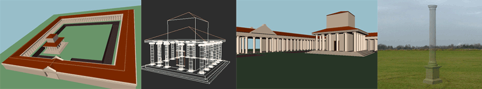
P. D. Ritsos, D. J. Johnston, C. Clark, and A. F. Clark, “Mobile augmented reality archaeological reconstruction,” in 30th UNESCO Anniversary Virtual Congress: Architecture, Tourism and World Heritage, Beijing, China, 2002.
This paper describes a mobile augmented reality system, based around a wearable computer, that can be used to provide in situ tours around archæological sites. Ergonomic considerations, intended to make the system usable by the general public, are described. The accuracy of the system is assessed, as this is critical for in situ reconstructions.
[Abstract]
[Details]
[PDF]