Journal paper published in Environmental Modelling & Software
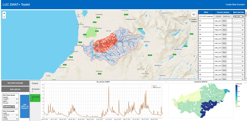
Our paper “LUCST: A novel toolkit for Land Use Land Cover change assessment in SWAT+ to support flood management decisions” has been published in Elsevier’s Environmental Modelling & Software. LUCST is an open-source, locally hosted, JavaScript application that allows for editing and interpreting SWAT+ files relevant to land-use land-cover changes. LUCST employs visual analytics, to facilitate easier change detection in catchments, and enhances SWAT+ accessibility by reducing scenario modelling complexity.
Reference
A. M. F. Rigby, P. W. S. Butcher, P. D. Ritsos, and S. D. Patil, “LUCST: A novel toolkit for Land Use Land Cover change assessment in SWAT+ to support flood management decisions,” Environmental Modelling & Software, vol. 156, no. 105469, Aug. 2022.
Land Use Land Cover (LULC) change is widely recognised as one of the most important factors impacting the hydrological response of river basins. SWAT +, the latest version of the Soil and Water Assessment Tool, has been used extensively to assess the hydrological impacts of LULC change. However, the process of making and assessing such changes in SWAT+ is often cumbersome and non-intuitive, thereby reducing its usability amongst a wider pool of applied users. We address this issue by developing a user-friendly toolkit, Land Use Change SWAT+ Toolkit (LUCST), that will: (1) allow the end-user to define various LULC change scenarios in their study catchment, (2) run the SWAT+ model with the specified LULC changes, and (3) enable interactive visualisation of the different SWAT+ output variables. A good System Usability Score (79.8) and positive feedback from end-users promises the potential for adopting LUCST in future LULC change studies.
[Abstract]
[Details]
[PDF]
[doi:10.1016/j.envsoft.2022.105469]