Interactive visual analytics of hydrodynamic flux for the coastal zone
Abstract
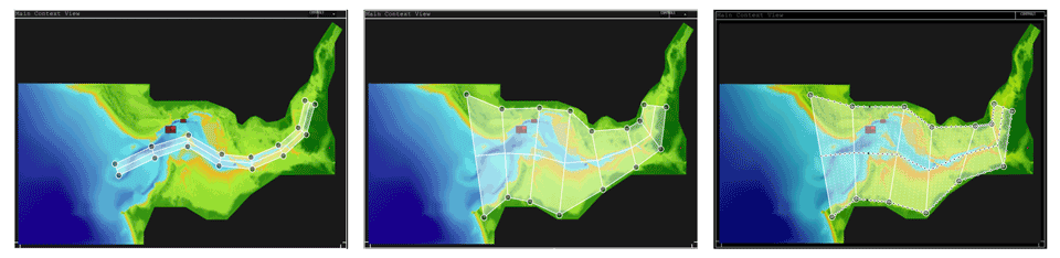
Researchers wish to study the potential impact of sea level rise from climate change, and visual analytic tools can allow scientists to visually examine and explore different possible scenarios from simulation runs. In particular, hydrodynamic flux is calculated to understand the net movement of water; but typically this calculation is tedious and is not easily achieved with traditional visualization and analytic tools. We present a visual analytic method that incorporates a transect profiler and flux calculator. The analytic software is incorporated into our visual analytics tool Vinca, and generates multiple transects, which can be visualized and analysed in several alternative visualizations; users can choose specific transects to compare against real-world data; users can explore how flux changes within a domain. In addition, we report how ocean scientists have used our tool to display multiple-view views of their data and analyse hydrodynamic flux for the coastal zone.
R. L. S. F. George, P. E. Robins, A. G. Davies, P. D. Ritsos, and J. C. Roberts, “Interactive visual analytics of hydrodynamic flux for the coastal zone,” Environmental Earth Sciences, vol. 72, no. 10, pp. 3753–3766, Nov. 2014.
doi:10.1007/s12665-014-3283-9
Bibtex
@article{George-et-al-Evn2014,
  author = {George, Richard L.S.F. and Robins, Peter E. and Davies, Alan G. and Ritsos, Panagiotis D. and Roberts, Jonathan C.},
  title = {Interactive visual analytics of hydrodynamic flux for the coastal zone},
  journal = {Environmental Earth Sciences},
  year = {2014},
  month = nov,
  volume = {72},
  number = {10},
  pages = {3753--3766},
  publisher = {Springer Berlin Heidelberg},
  doi = {10.1007/s12665-014-3283-9}
}